Archaeologist sailing like a Viking makes unexpected discoveries
Published 21 May 2025
The Vikings did not navigate by map, compass or sextant. Instead, they used “mental maps” where memories and experiences played a crucial role. They also used myths linked to various coastal landmarks.
“Examples include Viking stories about the islands Torghatten, Hestmona and Skrova off the Norwegian coast. The stories serve to remind sailors of the dangers surrounding these places, or of their importance as navigation marks.”
These preserved myths are the last remnants of what must once have been a landscape steeped in stories. Jarrett calls this a “Maritime Cultural Mindscape”. Small islets, skerries and reefs were all part of a web of stories that helped the Vikings navigate through the landscape; and that were passed down through generations of seafarers.
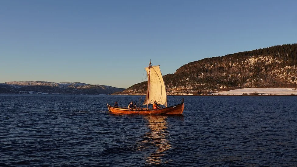
Through a combination of direct experience of the characteristics of the boats, and digital reconstruction of what the landscape looked like in the Viking Age, Jarrett has identified four possible Viking harbours along the Norwegian coast in his latest publication. (See image)
The locations of these ports (Jarrett calls them “havens”) are farther out to sea than the major ports and hubs, known to date.
“With this type of boat, it has to be easy to get in and out of the harbour in all possible wind conditions. There must be several routes in and out. Shallow bays are not an issue because of the shallow draft of the boats. Getting far up the narrow fjords, however, is tricky. They are difficult to sail upwind with a square rig, and the boats are sensitive to katabatic winds.”
If you don't have a crew that can cooperate and put up with each other for long periods, these journeys would probably be impossible
Jarrett's hypothesis is that during the Viking Age, such small, easily accessible harbours abounded. Places where sailors could pause, rest, and meet other seafarers.
“A lot of the time, we only know about the starting and ending points of the trade that took place during the Viking Age. Major ports, such as Bergen and Trondheim in Norway, Ribe in Denmark, and Dublin in Ireland. The thing I am interested in is what happened on the journeys between these major trading centres. My hypothesis is that this decentralised network of ports, located on small islands and peninsulas, was central to making trade efficient during the Viking Age.”
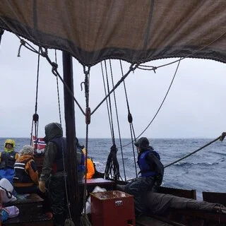
Jarrett's research trips have faced a few challenges. On their way back from Lofoten in May 2022, the yard (mast spar) holding up the mainsail broke as they sailed through the middle of Vestfjorden. The accident happened with the vessel 25 kilometres out to sea.
“We had to lash two oars together to hold the sail, and hope that it would hold. We made it back to the harbour safely, but then we had to spend several days repairing the boat before we could sail again.”
“On another trip, a minke whale suddenly surfaced and flapped its huge tail fin just metres from the boat.”
Jarret's adventures have also highlighted how important relationships must have been during the Viking voyages.
“You need a boat that can withstand all kinds of weather conditions. But if you don't have a crew that can cooperate and put up with each other for long periods, these journeys would probably be impossible,” Jarrett concludes.
Publication:
https://www.lunduniversity.lu.se/article/archaeologist-sailing-viking-makes-unexpected-discoveries
Link to the article in Journal of Archaeological Method and Theory:
https://link.springer.com/article/10.1007/s10816-025-09708-6